Saving Venice from flooding may destroy the ecosystem that sustains it
A system of moveable walls, called Moses, protects Venice from colossal high tides that are worsening with climate change. But they’re also destroying the marshes that keep the lagoon alive.
Assigned for NATIONAL GEOGRAPHIC
Text by Frank Viviano
Photographs by Marco Zorzanello
Photoeditor Maura Friedman


The main gate of Palazzo Ducale in Venice on November 13, 2019. Over the night before, the second highest tide ever recorded submerged parts of the city in six feet of water.
VENICE, ITALY — The cataclysmic flood of November 12, 2019, washed unremarkably into Venice, Italy’s Piazza San Marco around 6 a.m. Two hours later, the rising waters began to tail off at about three feet above normal sea level, leaving 90 percent of the city untouched. Venetians breathed a collective sigh of relief. It was just another mildly unpleasant acqua alta, high tide, in the lagoon.
The calm lasted until 4 p.m., just before night fell. Sirens began to sound... [READ HERE THE FULL ARTICLE by Frank Viviano]

St. Mark's Square is one of the lowest areas in Venice, making it especially vulnerable to high tides.

This vessel, called a Jack-up, was created to install and maintain the gates of Moses.
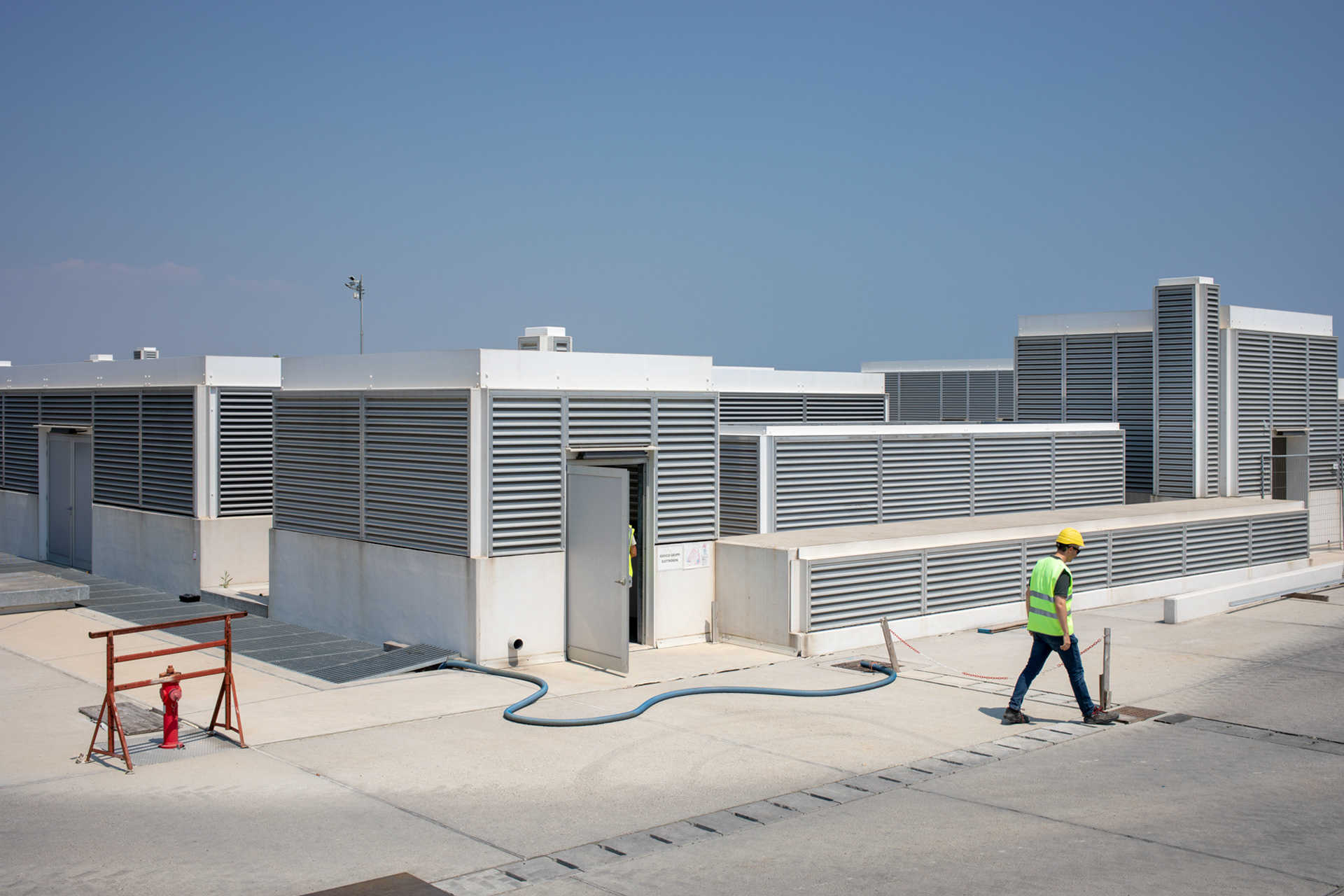
One of the buildings that support the Moses system of tidal flood walls that protect the city. The mobile gates, installed at three inlets off the city's shores, rise to protect Venice from increasingly higher tides from the Adriatic Sea.

A researcher from the National Center for Research (CNR) calibrates a testing machine for monitoring sea water quality. As tides rise and flood Venice more often, the public organization is using the city as a model for Mediterranean coastal flooding.

The Acqua Alta research tower was installed on January 1970 off the Gulf of Venice by the CNR, to conduct scientific experiments and research. The tide forecast for the Venetian authorities comes from this station so that they can decide when Moses's walls should be raised.

The Moses barriers were tested on the Lido inlet gate in 2019. Under normal tidal conditions, the gates are full of water and rest in their housing structures. When a high tide is forecast, compressed air is introduced into the gates to empty them, and they rise, stopping the tide from entering the lagoon.
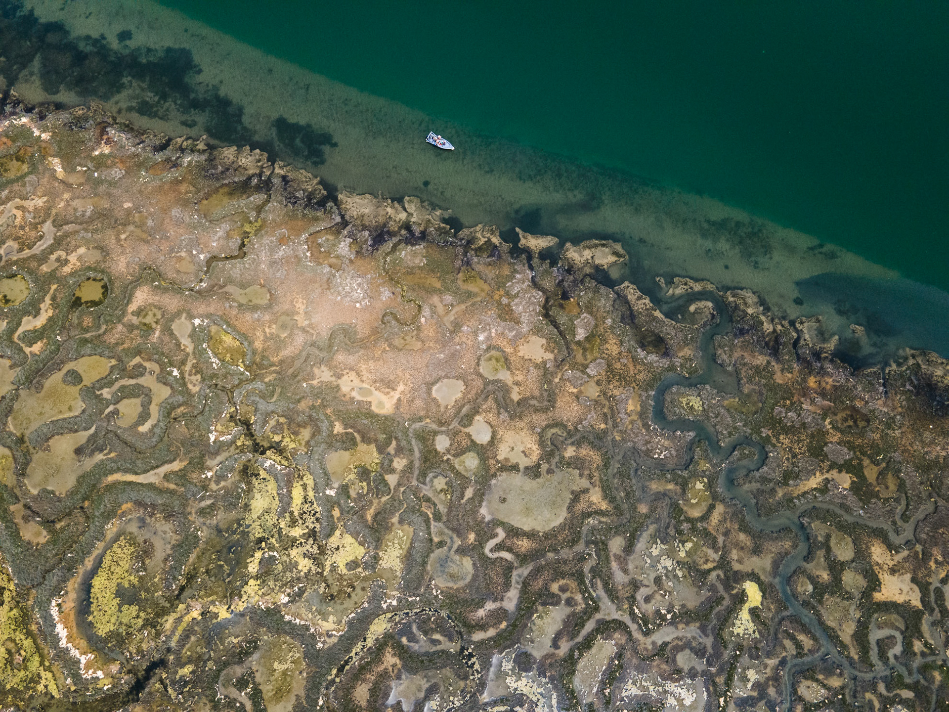
This natural salt marsh around the Venetian Lagoon has irregularly shaped banks and serpentine internal channels, essential for absorbing high tides.

This invasive grass, called Spartina, was found for the first time in the Venetian Lagoon in the early 2000s. Scientists are still deciding whether the grass is beneficial to the ecosystem.
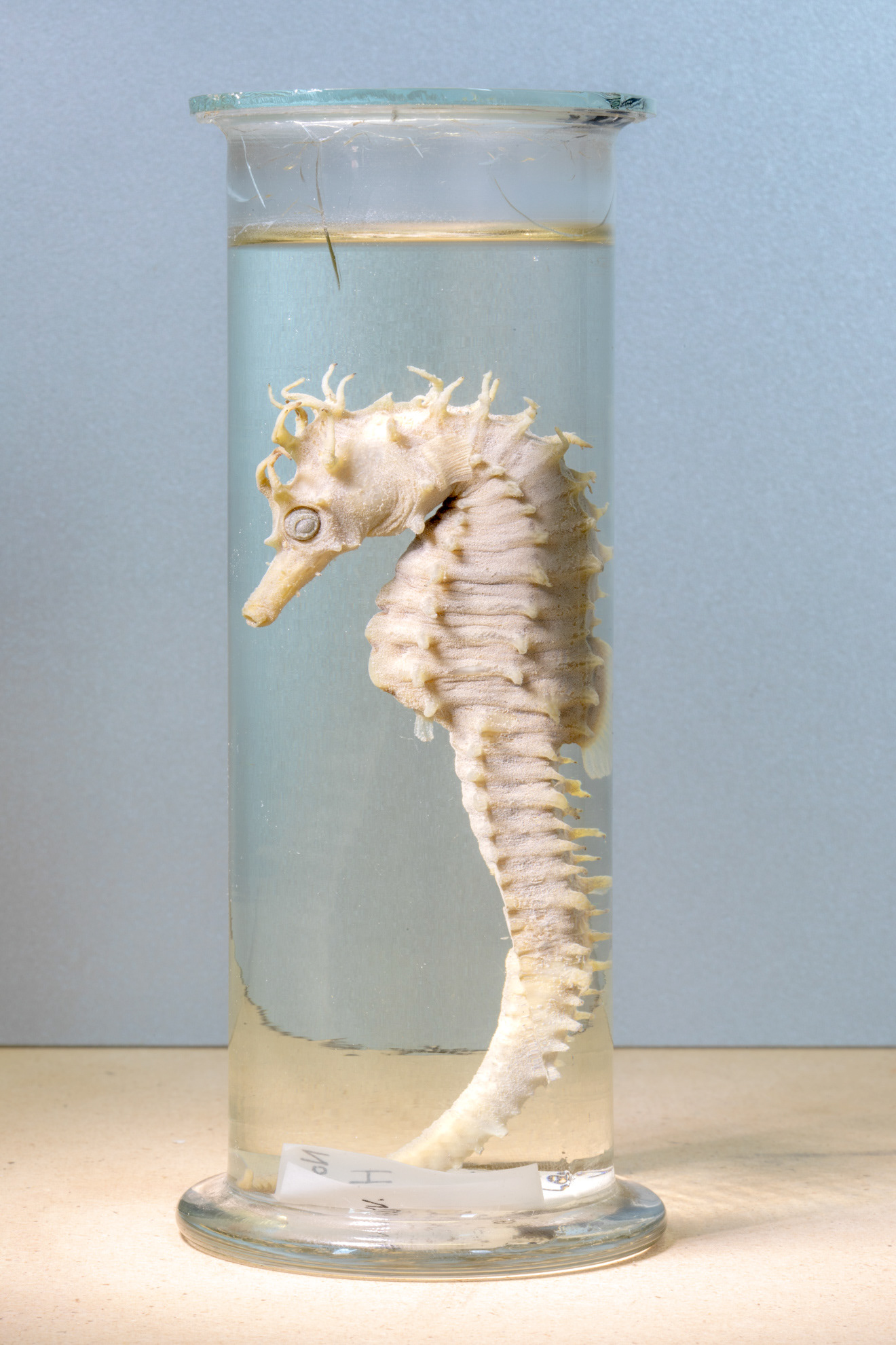
Seahorses like this museum species have been reintroduced in the grasses of the lagoon after being decimated by the farming of an invasive clam.

On the left, environmental engineer Alberto Barausse of the University of Padua is inspecting the surrounding area. Biologist Davide Tagliapietra, center, and station Director Laura Airoldi compare notes on a freshly collected sample of invasive Spartina.
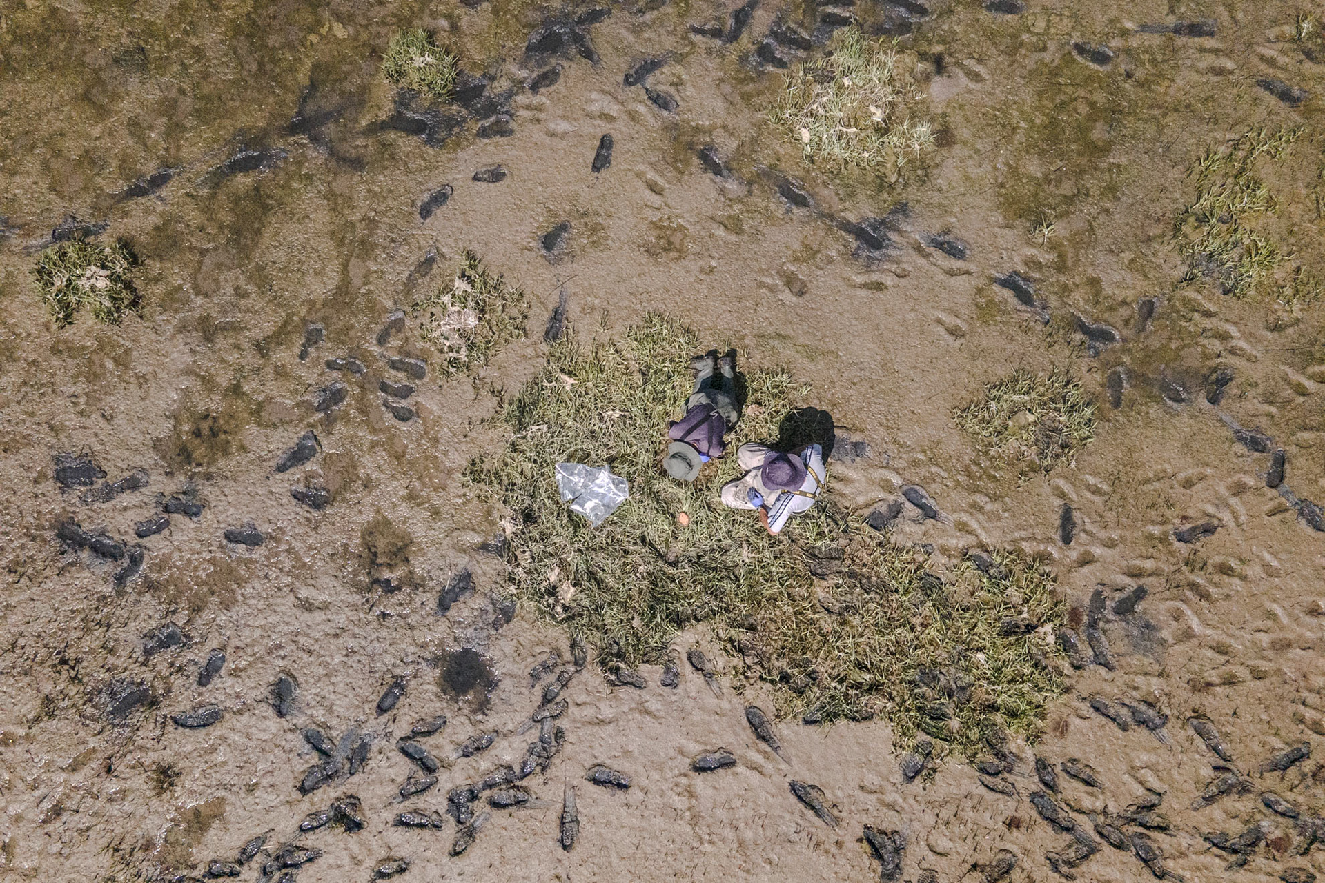
Researchers collect soil samples from an artificial sandbar in the Venetian Lagoon. The aim of this activity is to study insects and microorganisms present in these soils, to understand the differences between a natural and an artificial sandbar.

This artificial sandbar is being built with sediment dredged from the deepest navigable waterway in Venice Lagoon.

The lagoon near the island of Mazzorbo

These boxes are used to fish crabs in the lagoon.

An aerial view of the island of Burano in the Venetian Lagoon.

Fog descends on the lagoon.